We're excited to share some new features we've added to ZoLa! Scroll through the updates below, or select the "Features" tab at any time to view the new additions.
❮
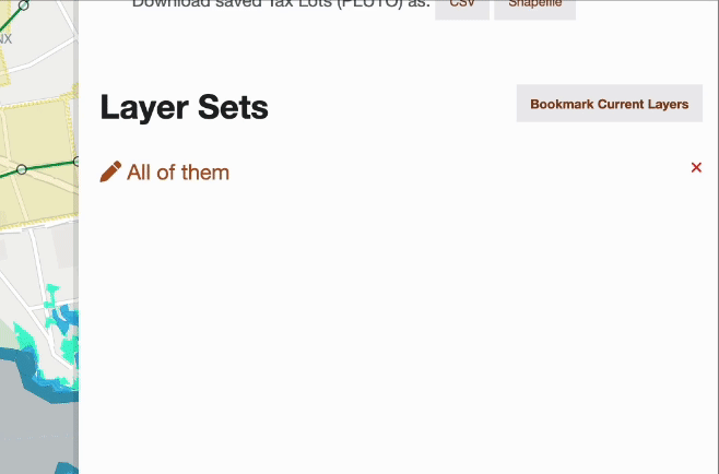
Bookmark your selected layers
to return to later
❯
Don't show this message again
×
ZoLa
New
York
City's
Zoning & Land Use Map
Menu
About
Features
New!
Data
Saved
Homepage
Search the map
BBL Lookup
<
Locate Me
×
Edit Map Layers
Toggle All Map Layers Off
Zoning and Land Use
3
Toggle Layer Group
Tax Lots
Show Land Use Colors
Toggle Layer Group
Zoning Districts
Commercial Districts
C1
C2
C3
C4
C5
C6
C7
C8
Manufacturing Districts
M1
M2
M3
Residence Districts
R1
R2
R3
R4
R5
R6
R7
R8
R9
R10
Parks
Battery Park City
Toggle Layer Group
Commercial Overlays
C1-1 through C1-5
C1-1
C1-2
C1-3
C1-4
C1-5
C2-1 through C2-5
C2-1
C2-2
C2-3
C2-4
C2-5
Toggle Layer Group
Zoning Map Index
Toggle Layer Group
Zoning Map Amendments
Toggle Layer Group
Pending Zoning Map Amendments
Toggle Layer Group
Special Purpose Districts
Toggle Layer Group
Special Purpose Subdistricts
Supporting Zoning Layers
Toggle Layer Group
Mandatory Inclusionary Housing Areas
Toggle Layer Group
Inclusionary Housing Designated Areas
Toggle Layer Group
Greater Transit Zone
Toggle Layer Group
Transit Zones Parking Geographies
Toggle Layer Group
FRESH Zones
Toggle Layer Group
Limited Height Districts
Toggle Layer Group
Lower Density Growth Management Areas
Toggle Layer Group
Coastal Zone Boundary
Toggle Layer Group
Waterfront Access Plan
Toggle Layer Group
Historic Districts
Toggle Layer Group
Landmarks
Toggle Layer Group
Effective Flood Insurance Rate Maps 2007
Toggle Layer Group
Preliminary Flood Insurance Rate Maps 2015
Toggle Layer Group
Environmental Designations
Toggle Layer Group
Appendix I
Toggle Layer Group
Appendix J Designated M Districts
Other Supporting Layers
Toggle Layer Group
Business Improvement Districts
Toggle Layer Group
Industrial Business Zones
Administrative Boundaries
Toggle Layer Group
Boroughs
Toggle Layer Group
Community Districts
Toggle Layer Group
NYC Council Districts
Toggle Layer Group
NY State Senate Districts
Toggle Layer Group
NY State Assembly Districts
Toggle Layer Group
Neighborhood Tabulation Areas
Basemaps
2
Toggle Layer Group
Subways
Toggle Layer Group
Building Footprints
Toggle Layer Group
3D Buildings
Toggle Layer Group
Aerial Imagery
×